


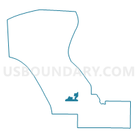
Voting District 0291480000004, Charlevoix County, Michigan
About
Outline

Summary
| Unique Area Identifier | 596199 |
| Name | Voting District 0291480000004 |
| County | Charlevoix County |
| State | Michigan |
| Area (square miles) | 7.67 |
| Land Area (square miles) | 5.94 |
| Water Area (square miles) | 1.73 |
| % of Land Area | 77.42 |
| % of Water Area | 22.58 |
| Latitude of the Internal Point | 45.29955620 |
| Longtitude of the Internal Point | -85.30897120 |
Maps


Graphs
Select a template below for downloading or customizing gragh for Voting District 0291480000004, Charlevoix County, Michigan


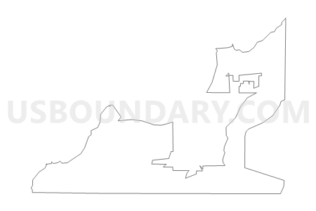
Neighbors
Neighoring Voting District (by Name) Neighboring Voting District on the Map
- Voting District 0291478001000, Charlevoix County, MI
- Voting District 0291478002019, Charlevoix County, MI
- Voting District 0291478003020, Charlevoix County, MI
- Voting District 0292668000006, Charlevoix County, MI
- Voting District 0293732000007, Charlevoix County, MI
- Voting District 0295162000009, Charlevoix County, MI
- Voting District 0295934000011, Charlevoix County, MI
- Voting Districts not defined, Charlevoix County, MI
Top 10 Neighboring County Subdivision (by Population) Neighboring County Subdivision on the Map
- Charlevoix city, Charlevoix County, MI (2,513)
- Hayes township, Charlevoix County, MI (1,919)
- Marion township, Charlevoix County, MI (1,714)
- Charlevoix township, Charlevoix County, MI (1,645)
- Eveline township, Charlevoix County, MI (1,484)
- Norwood township, Charlevoix County, MI (723)
Top 10 Neighboring Place (by Population) Neighboring Place on the Map
Top 10 Neighboring Unified School District (by Population) Neighboring Unified School District on the Map
Top 10 Neighboring State Legislative District Lower Chamber (by Population) Neighboring State Legislative District Lower Chamber on the Map
Top 10 Neighboring State Legislative District Upper Chamber (by Population) Neighboring State Legislative District Upper Chamber on the Map
Top 10 Neighboring 111th Congressional District (by Population) Neighboring 111th Congressional District on the Map
Top 10 Neighboring Census Tract (by Population) Neighboring Census Tract on the Map
- Census Tract 8, Charlevoix County, MI (2,928)
- Census Tract 4, Charlevoix County, MI (2,762)
- Census Tract 15, Charlevoix County, MI (2,579)
- Census Tract 9, Charlevoix County, MI (1,813)